
When Will El Nino Hit California? Forecast for Los Angeles, San Diego and San Francisco
California’s strongest El Niño impacts may not arrive until winter deepens.
 IN
Tue, Sep 22, 2026 | 05:13 PM IST
IN
Tue, Sep 22, 2026 | 05:13 PM IST


California is preparing for an unusually powerful Pacific climate event that could reshape the state’s winter, but residents should not expect one specific date when El Nino suddenly “hits.” The climate pattern is already underway. NOAA’s Climate Prediction Center confirmed in September that ocean and atmospheric conditions are consistent with a strengthening event. Forecasters now give it a greater than 90% chance of reaching very strong intensity during the Northern Hemisphere fall and winter of 2026–27. There is also a 75% chance the October-to-December period could reach a level stronger than previous events in NOAA’s record dating to 1950. What Californians are waiting for is the weather response. Current seasonal guidance points to a greater likelihood of wetter-than-normal conditions as winter develops, with scientists saying the clearest signal for California typically emerges from around January through April. That could mean stronger storms, intense rainfall, coastal erosion and periods of flooding—but it does not guarantee that every city will experience extreme weather.
The current California Weather Forecast suggests that the most meaningful impacts are likely to develop from late fall into winter rather than immediately in September. Scripps Institution of Oceanography researcher Alexander Gershunov says the typical western US influence tends to become more apparent in January, with January through April offering the strongest seasonal prediction signal for California.
That does not mean the state will remain dry until January. Individual storms can arrive before then. What changes later in the season is the probability that the broader atmospheric pattern will repeatedly favour wetter conditions. NOAA’s latest seasonal outlook shows increasing chances of above-normal precipitation across California from late fall into early spring, with probabilities reaching roughly 50% to 60% near parts of the California coast during the strongest winter signal. For residents following the California Rainfall Forecast, December may mark the beginning of a wetter pattern, while January through March could become the period to watch most closely.
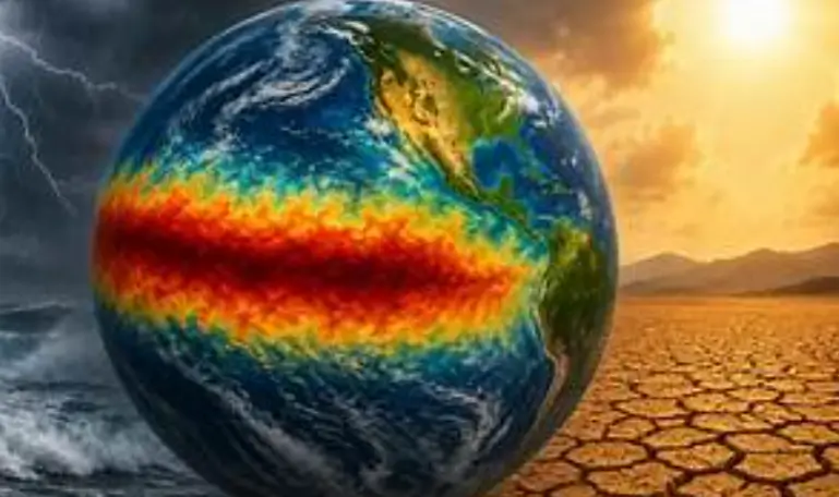
El Nino 2026 has strengthened rapidly. NOAA reported in September that sea-surface temperature anomalies had exceeded 3°C in parts of the eastern equatorial Pacific. The Niño-3.4 index reached approximately +1.8°C, while waters farther east were even warmer. NOAA’s official forecast gives a greater than 90% probability of a very strong event during fall and winter.
That increases confidence that the atmosphere could behave in ways typically associated with the climate pattern. But strength does not translate directly into rainfall totals. NOAA explicitly warns that even an exceptionally strong event does not guarantee a particular weather outcome in any one location. Other atmospheric patterns, including the position of the jet stream and individual atmospheric rivers, will ultimately determine when and where heavy rain falls. That makes El Nino 2026 important for seasonal planning, but not a substitute for shorter-range storm forecasts.
Los Angeles sits in the part of California where a strong event historically produces one of the clearer wet-season signals. During many powerful events, the Pacific storm track shifts southward and allows storms to reach Southern California more directly. Scripps scientists note that this pattern can expose Southern California to larger winter storms and heavier rainfall. For Los Angeles, the main concerns include:
This does not mean Los Angeles will experience continuous rain for months. The more realistic pattern is periods of dry weather interrupted by potentially powerful storm systems. The California Weather Forecast therefore points toward increased seasonal risk rather than a daily prediction for LA months in advance.
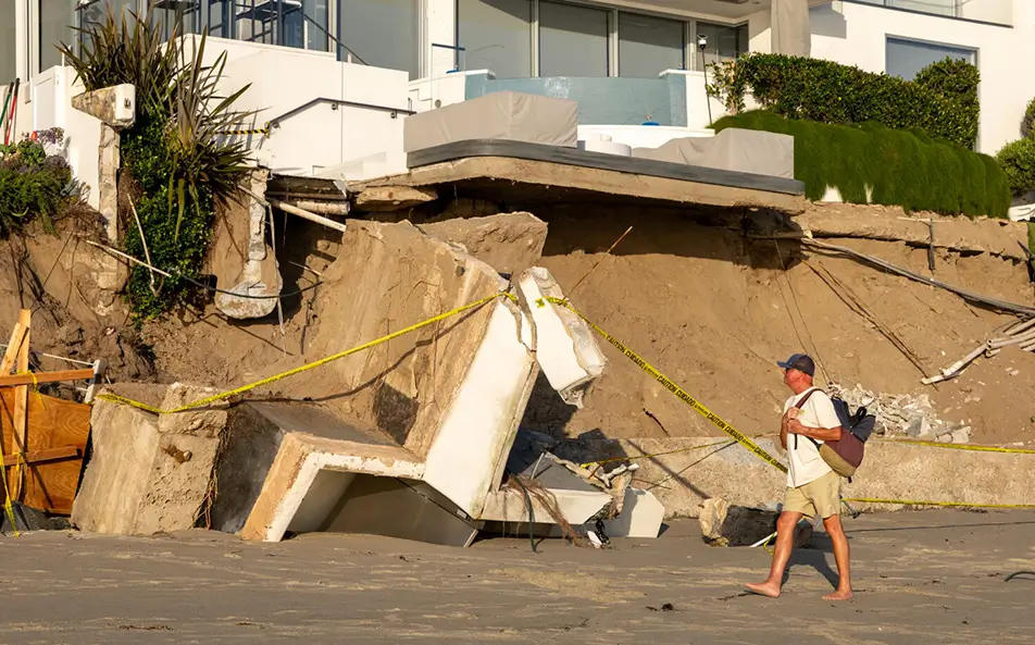
San Diego is another area where the winter signal is particularly important. Scripps researchers say strong events can push the Pacific storm track farther south, increasing storm exposure across Southern California and northern Baja California. San Diego County also has an extensive coastline with beaches, bluffs and cliffs vulnerable to the combination of higher seas, heavy rain and large waves. El Niño conditions can temporarily raise sea levels along California by roughly 15 to 30 centimetres, according to Scripps, while powerful waves and saturated cliffs can increase erosion and landslide risk.
Communities such as Del Mar, Encinitas, Carlsbad, Oceanside and other low-lying or bluff-lined coastal areas could therefore face multiple hazards if strong storms coincide with large surf and high tides. This is why the california flooding weather risk is not limited to rainfall alone.
Northern California’s outlook is more complicated. Southern California generally has a stronger historical connection between powerful El Niño winters and increased rainfall. Northern California often sits closer to the transition zone where outcomes can vary more substantially.
Still, NOAA’s current outlook favours above-normal precipitation across much of California during the winter season, including portions of the coast farther north. San Francisco and the Bay Area could therefore experience wet periods, atmospheric rivers and coastal impacts. But it would be inaccurate to say today that San Francisco will definitely receive a specific amount of rain or twice its normal annual rainfall.
Seasonal forecasts months ahead provide probabilities, not reliable city-level rainfall totals. Residents should therefore treat any precise long-range rain figure with caution until shorter-range forecasts become available.
The California Rainfall Forecast becomes more meaningful as the state moves deeper into winter. Scripps scientists say the influence on western US weather generally becomes clearer around January, with January through April historically providing the strongest prediction window. One reason is the subtropical jet stream.
During strong events, that jet can become more energetic and shift storm activity toward the southern United States, including California.
That creates conditions capable of delivering repeated Pacific storms. However, California’s most damaging floods often involve atmospheric rivers, and Scripps stresses that atmospheric rivers can occur regardless of ENSO conditions. The climate pattern may affect their intensity and orientation, but it does not independently determine whether a specific atmospheric river will strike Los Angeles, San Diego or San Francisco. That distinction is crucial for understanding the seasonal outlook.
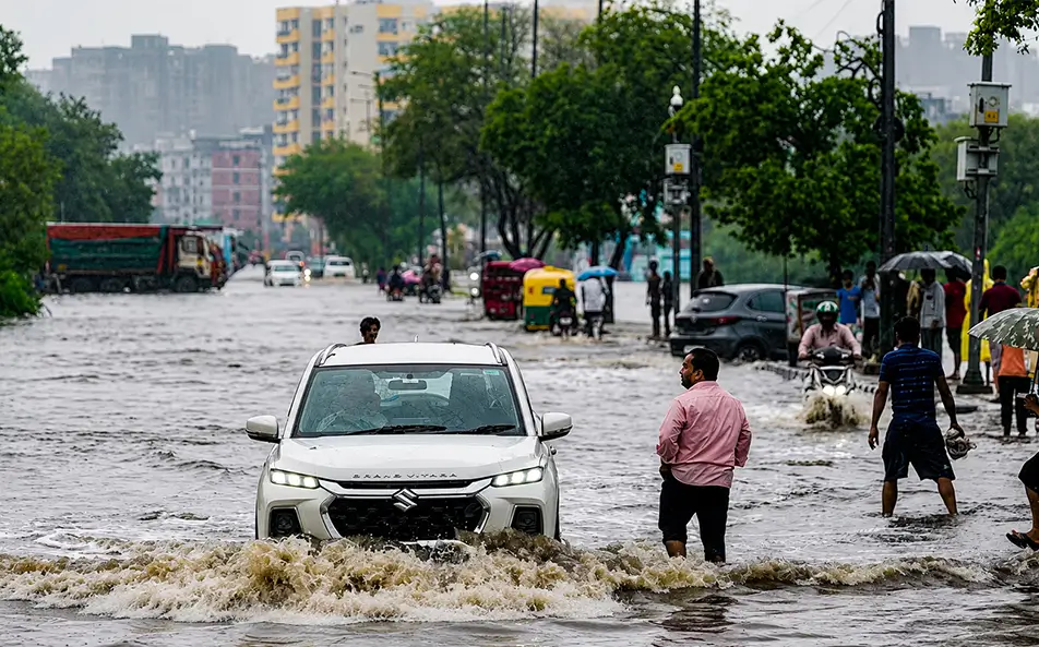
Yes, the risk is elevated—but widespread flooding is not guaranteed. The california flooding weather threat becomes highest when several factors happen together: saturated soil, intense rainfall, atmospheric rivers, high tides and large coastal waves. Recently burned areas face an additional hazard because wildfire removes vegetation that normally helps hold soil in place. Heavy rainfall over burn scars can produce fast-moving debris flows.
Coastal areas face another combination of risks. El Niño can raise coastal water levels, while storms generate large waves. When those waves arrive during high tide, flooding and beach or cliff erosion can become much more severe. California officials are taking those possibilities seriously.
Governor Gavin Newsom declared a statewide state of emergency on September 21, allowing agencies to prepare equipment, flood-control resources, emergency supplies and National Guard support before winter storms intensify. The declaration is a preparedness action, not evidence that a specific catastrophic storm is imminent.
Rain is only part of the California winter weather story. Storms reaching the state during colder periods can also produce significant snowfall across the Sierra Nevada. That can benefit California’s water supply because the mountain snowpack stores water that later melts into reservoirs and rivers.
But exceptionally intense storms can create problems including:
The balance between rain and snow depends heavily on individual storm temperatures and snow levels, which cannot be reliably predicted months ahead. That means the California winter weather outlook may be wetter overall while still containing major uncertainty about snowpack quality and individual storm impacts.
Confidence in the broad seasonal pattern is already relatively high because the tropical Pacific signal is exceptionally strong. Confidence about individual storms is much lower.
Weather forecasters typically become far more reliable about specific rainfall events within days rather than months. By November and December, forecasters should have a clearer view of how the Pacific jet stream and other atmospheric patterns are developing.
Once major storms begin forming, National Weather Service forecasts can provide much more specific information about rainfall amounts, timing, snow levels and flood risks. That is when residents should shift from following a seasonal California Weather Forecast to local short-range warnings.
The most accurate answer is not that one huge storm will suddenly mark the arrival of El Nino. The climate pattern is already present. Instead, its influence is expected to become increasingly visible as California enters its main rainy season, with the strongest signal likely from roughly January through early spring. The latest California Rainfall Forecast tilts wetter than normal, particularly along the coast, while Southern California has historically shown one of the clearest responses during strong events.
Los Angeles and San Diego should prepare for the possibility of heavy rainfall, urban flooding, landslides and coastal impacts. Northern California could also experience significant storms, although its relationship with the pattern is generally less consistent. The key takeaway from the current california flooding weather outlook is probability—not certainty.
A very strong event raises the chances of an unusually wet California winter weather season. It cannot tell residents today which neighbourhood will flood, which week the heaviest storm will arrive or exactly how much rain any city will receive.
Those answers will only become available as individual winter storms begin to develop.
For more updates like this, follow The United Indian and stay informed with the latest news that matters.
Everything you need to know
El Niño conditions are already present, so there is no single arrival date. Scripps climate scientist Alexander Gershunov says its influence on western U.S. weather typically becomes clearer around January, with January through April providing the strongest seasonal signal.
NOAA says El Niño is strengthening and gives it a greater than 90% chance of becoming very strong during fall and winter 2026–27. NOAA also puts the chance of the October–December period reaching historically exceptional strength at about 75%.
Southern California historically has one of the clearer wet-weather relationships with strong El Niño events. Scripps says the odds tilt toward a wetter-than-normal winter, but this does not guarantee heavy rain in Los Angeles or any specific storm.
Yes, the risk can increase, particularly when heavy storms coincide with saturated ground, atmospheric rivers, high tides or large waves. California has already activated statewide preparedness measures for possible flooding, landslides, debris flows and coastal impacts.




Sep 16, 2026
TUI Staff
Sep 15, 2026
TUI Staff
Sep 04, 2026
TUI Staff
Sep 04, 2026
TUI Staff
Sep 21, 2026
TUI Staff
Sep 21, 2026
TUI Staff
Sep 21, 2026
TUI Staff
Sep 21, 2026
TUI Staff

Stay informed with independent, fact-checked journalism on technology, environment, government, economy and more. India’s most trusted digital news platform.


Comments (0)
Be the first to comment!