
Four Storms, Four Countries, One Crisis: Why Typhoon Saudel Is Making Headlines
Four storms. Two countries. One rapidly evolving weather crisis.
 IN
Thu, Oct 15, 2026 | 04:31 PM IST
IN
Thu, Oct 15, 2026 | 04:31 PM IST


A storm can cross hundreds of kilometres. Its disruption can travel much farther.
In late August 2026, East Asia found itself watching four tropical systems at almost the same time - Saudel, Narra, Gaenari and Atsani. The unusual cluster brought heavy rain, evacuations, power cuts and transport disruptions across parts of the region.
At the centre of the story was a powerful typhoon that moved from the western Pacific towards Japan and then China. For people watching from India, the story is also a reminder of how quickly weather disruptions can spill into international travel, shipping and business.
The system that became Saudel developed over the western Pacific and strengthened rapidly. Japan's weather authorities tracked it as Typhoon No. 18, while international agencies followed its progress as it moved west-northwest towards Japan.
Weathernews, citing Japan Meteorological Agency forecasts, reported that Saudel was expected to strengthen to a very strong typhoon, with central pressure falling to around 940 hPa and maximum sustained winds reaching about 167 km/h.
The U.S. National Weather Service later recorded maximum sustained winds of 115 mph (about 185 km/h) as the storm approached Okinawa, while warning that tropical-storm-force winds extended hundreds of miles from its centre.
The storm then followed a westward track. By August 26, Typhoon Saudel moves west over the East China Sea after passing Japan's southwestern islands, putting China's eastern coast in its sights.
Okinawa and the Amami island chain bore the brunt of the storm before it reached China.
According to the Associated Press, winds reached up to 144 km/h, while the Amami region received more than 23 centimetres of rain in 24 hours. The Japan Meteorological Agency also issued a landslide warning.
The disruption to everyday life was immediate. More than 150 flights to and from Okinawa's Naha Airport were cancelled, while over 30,000 homes in Kagoshima Prefecture lost power. Two elderly women suffered minor injuries in separate incidents linked to the storm and blackout conditions.
These Japan flight cancellations mattered beyond the islands themselves. Naha is an important regional aviation gateway, and when airports close because of severe weather, passengers can face knock-on delays well after the storm has moved away.
Reports differed on the exact number of cancelled flights, with some regional reporting putting the total considerably higher. That variation is common during fast-moving disasters, when cancellations are added or reinstated throughout the day.
Taiwan was also closely watching the storm, although Saudel did not make a direct landfall there.
The storm passed north of the island and weakened, but its outer bands still brought concerns about heavy rain and strong winds. This was particularly important because Taiwan was already dealing with severe rainfall from another weather system.
That distinction matters: not every disruption reported across the region was caused by Saudel alone.
After crossing the East China Sea, Saudel reached China's eastern coast on August 28.
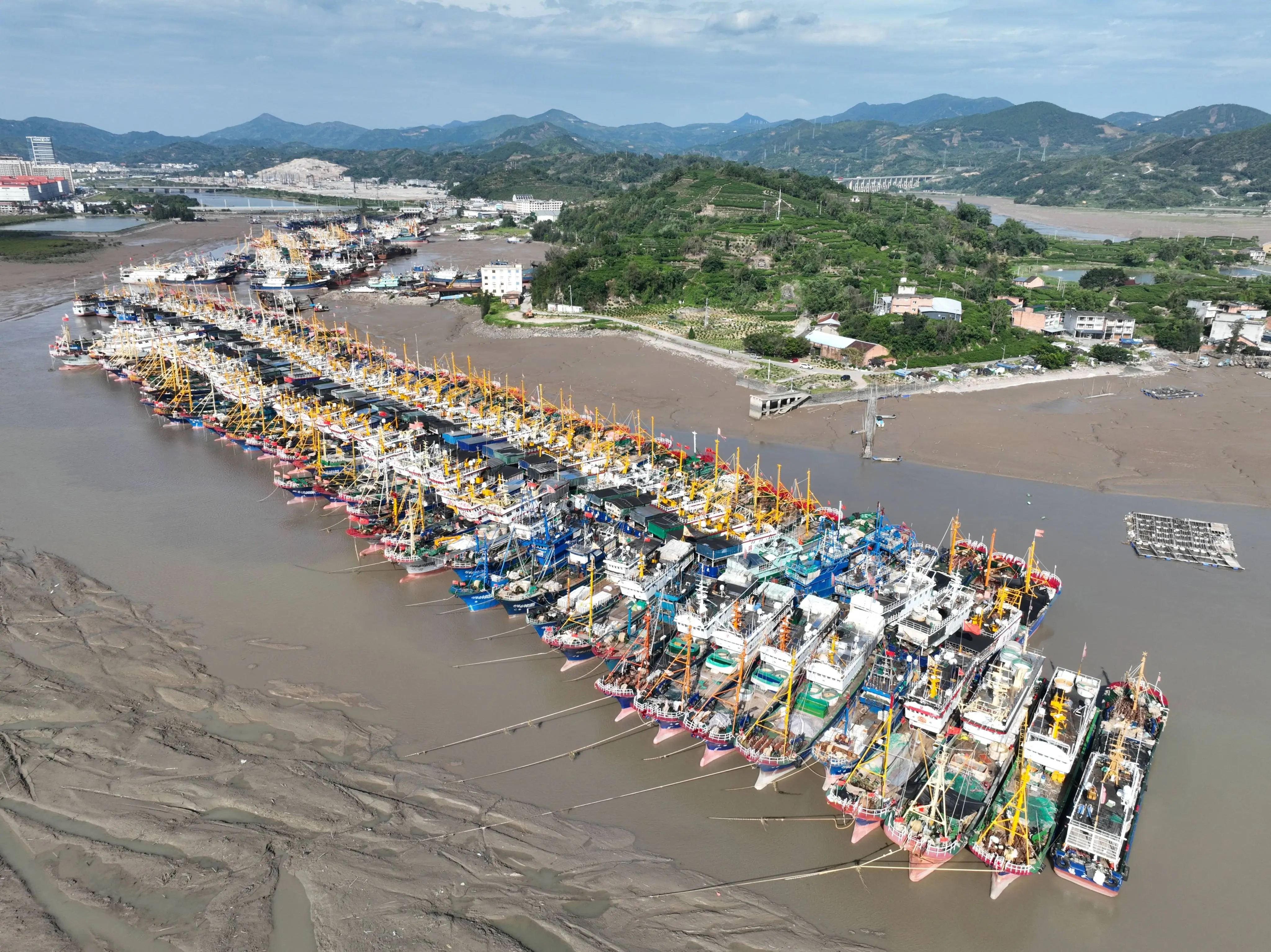
Reuters reported that the storm made two landfalls in Zhejiang province that morning - first near Taizhou at about 8:05 a.m. and then near Wenzhou around 9:10 a.m. It became the third typhoon to strike Zhejiang in 2026.
The response was extensive.
Wenzhou authorities ordered the evacuation of more than 820,000 people, while Taizhou identified another 52,000 people for evacuation. Train services were suspended on several lines, while passenger ferry operations were halted in Zhejiang and Fujian.
The storm also threatened heavy rainfall across Zhejiang and Fujian, with its remnants expected to affect areas farther inland.
This is where the Typhoon Saudel latest update becomes particularly important. The storm weakened after moving inland, but its weather story did not immediately end there.
Saudel was approaching China's eastern coast while Narra was already causing serious flooding in southern China.
Reuters reported that more than 54,000 people had been evacuated because of flooding associated with Narra. River levels rose dangerously in Guangxi, while homes and low-lying areas were inundated.
That created a dangerous sequence. When another tropical system arrives after heavy rain, the ground may already be saturated and rivers may still be swollen. Even if the second system is weaker, additional rainfall can increase the risk of flooding and landslides.
It is therefore important not to attribute all of southern China's earlier flooding to Saudel. Narra was responsible for much of that earlier rainfall and flooding, while Saudel's major direct impact came later along China's eastern coast.
Img Src : Typhoon Saudel
The four-system setup was unusual enough to attract international attention.
Saudel, Narra, Gaenari and Atsani were simultaneously active over the Northwest Pacific and South China Sea in late August. Chinese reporting described the spectacle as "four typhoons dancing together."
The four systems, however, were not equally strong or equally dangerous.
Narra brought major rainfall to southern China. Gaenari affected the Fujian region, while Atsani developed farther east. Saudel became the most powerful and travelled towards Japan before reaching China.
The science behind such clusters is linked partly to large-scale atmospheric patterns, including the monsoon trough, a broad zone that can provide favourable conditions for tropical cyclone development.
But calling the event unprecedented would be misleading. Historical analysis shows that simultaneous clusters of four or more tropical systems have occurred before. The 2026 event is better described as rare rather than without precedent.
The most recent development has added another twist.
After weakening over China, the remnants of Saudel moved south. On August 31, Vietnam's National Center for Hydro-Meteorological Forecasting reported that the system had reorganised into a tropical depression east of China's Leizhou Peninsula. It was moving southwest at around 10 km/h, with maximum sustained winds around 50–61 km/h.
Forecasters said the system could strengthen into a storm as it moves towards the northern East Sea. However, this remains a developing forecast and should not be presented as Saudel simply returning to its previous typhoon strength.
That makes the Typhoon Saudel latest situation one worth watching, particularly for marine and coastal communities in the region.
Saudel did not make landfall in India. But its wider impact shows why natural disasters in major Asian economies can matter to Indian travellers and businesses.
Air routes connecting India with East Asia can be affected when airports suspend operations. Shipping and logistics can also face delays when ports, ferries, railways or coastal infrastructure shut down for safety.
The lesson is not that every typhoon in Japan or China will disrupt India. Rather, it is that modern travel and supply chains are interconnected. A storm that closes an airport in Okinawa or stops ferry and rail services in Zhejiang can create delays that continue even after the skies begin to clear.
For Indian travellers, checking airline updates before flying through an affected hub is essential. For businesses, weather-related delays are another reason supply chains increasingly need contingency plans.
The real story is bigger than one storm.
Saudel brought strong winds and heavy rain to Japan before striking China. Narra had already left parts of southern China dealing with serious flooding. Gaenari and Atsani added to an unusually busy regional weather pattern.
Together, these systems showed how natural disasters can become cascading events. Flooded roads can disrupt transport. Power cuts can affect communications. Closed ports can delay cargo. And repeated rainfall can leave communities with little time to recover.
For now, authorities across the region are watching the latest tropical depression and assessing its next move.
The skies may have changed, but the lesson remains clear: when several storms arrive in quick succession, the greatest challenge is not always the strength of one storm - it is the pressure that each new system places on communities already struggling with the last one.
Everything you need to know
Typhoon Saudel was a powerful Western Pacific typhoon that moved toward Japan before making two landfalls in China's Zhejiang province on August 28, 2026.
It made two landfalls in Zhejiang, China, first near Taizhou and later near Wenzhou on August 28.
Okinawa and the Amami islands experienced strong winds, heavy rain, power outages and flight cancellations. More than 150 flights were cancelled through Naha Airport, while over 30,000 homes lost power in Kagoshima Prefecture.
Saudel, Narra, Gaenari and Atsani developed within the broader Northwest Pacific and South China Sea region, where large-scale atmospheric conditions can support multiple tropical systems simultaneously.
Saudel itself weakened after crossing China, but its remnants later reorganised into a tropical depression east of China's Leizhou Peninsula. Vietnamese forecasters said it could strengthen again, so the situation remains under observation.






Oct 15, 2026
TUI Staff
Oct 15, 2026
TUI Staff
Oct 14, 2026
TUI Staff
Oct 15, 2026
TUI Staff
Oct 15, 2026
TUI Staff
Oct 15, 2026
TUI Staff
Oct 14, 2026
TUI Staff

Stay informed with independent, fact-checked journalism on technology, environment, government, economy and more. India’s most trusted digital news platform.






Comments (0)
Be the first to comment!